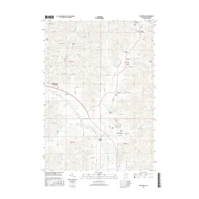
2016 Map of Sextonville
USGS Topo · Published 2016About this map
The Pine River and its meandering tributaries, including Willow Cr and Little Willow Cr, define the drainage of this Richland County landscape. The valley floors provide space for small unincorporated communities like Ithaca, Sextonville, and Twin Bluffs, while the surrounding terrain is marked by a high density of named hollows. Genealogists can find several burial grounds across the area, such as Sextonville Cem, Willow Valley Cem, and Ash Creek Cem.
Find a feature on this map
89 named features on this map. Tap any name to fly to it.
Don’t see what you’re looking for? This feature index may not catch every label — zoom into the map to look around manually.
Map Details
Editions of this 2016 Sextonville Map
This is the sole edition of this map. No revisions or reprints were ever made.
Other maps of this area

1905 · Richland Center
USGS Topo · 1:125,000

1958 · La Crosse
USGS Topo · 1:250,000

1960 · Richland Center
USGS Topo · 1:62,500

1960 · Plain
USGS Topo · 1:62,500

1960 · Muscoda
USGS Topo · 1:62,500

1960 · Spring Green
USGS Topo · 1:62,500

1961 · La Crosse
USGS Topo · 1:250,000

1965 · La Crosse
USGS Topo · 1:250,000

1976 · La Crosse
USGS Topo · 1:250,000
1983 · Lime Ridge
USGS Topo · 1:24,000