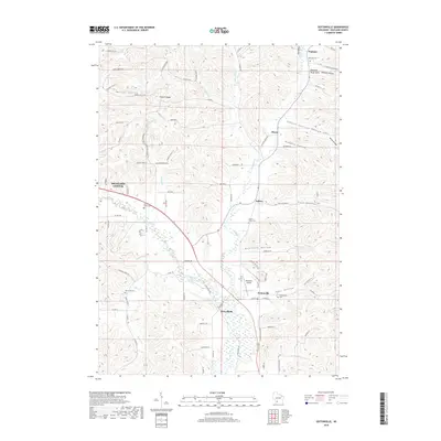
2018 Map of Sextonville
USGS Topo · Published 2018About this map
The Pine River and its tributary Willow Cr define the landscape of south-central Wisconsin in this detail-rich survey. The terrain is characterized by a series of prominent ridges and deep valleys, known locally as hollows, including School Section Hollow, Nebraska Hollow, and the aptly named Hell Hollow. These geographic features dictate the settlement patterns of rural communities like Sextonville and Ithaca, which sit at the base of the surrounding bluffs.
Find a feature on this map
89 named features on this map. Tap any name to fly to it.
Don’t see what you’re looking for? This feature index may not catch every label — zoom into the map to look around manually.
Map Details
Editions of this 2018 Sextonville Map
This is the sole edition of this map. No revisions or reprints were ever made.
Other maps of this area

1905 · Richland Center
USGS Topo · 1:125,000

1958 · La Crosse
USGS Topo · 1:250,000

1960 · Richland Center
USGS Topo · 1:62,500

1960 · Plain
USGS Topo · 1:62,500

1960 · Muscoda
USGS Topo · 1:62,500

1960 · Spring Green
USGS Topo · 1:62,500

1961 · La Crosse
USGS Topo · 1:250,000

1965 · La Crosse
USGS Topo · 1:250,000

1976 · La Crosse
USGS Topo · 1:250,000
1983 · Lime Ridge
USGS Topo · 1:24,000