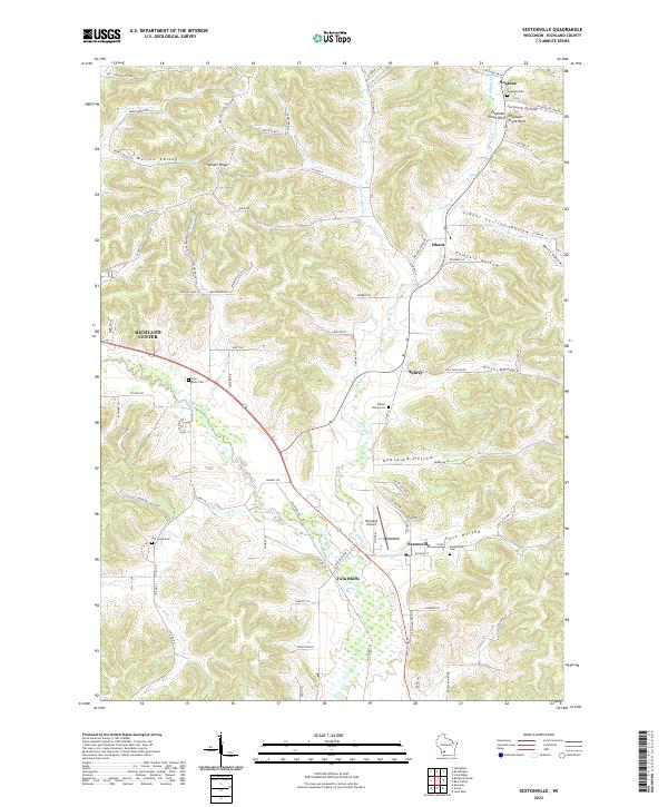
2022 Map of Sextonville
USGS Topo · Published 2022About this map
Sextonville and the winding Pine River anchor this topographic view of Richland County, where the landscape is defined by a dense network of coulees and hollows. The terrain transitions from the broad river valley to the steep elevations of Hulster Ridge and the distinctively named Elephant Trunk Rock near Neptune. This survey documents a rural infrastructure of small settlements like Twin Bluffs and Aubrey, connected by winding roads that follow the natural contours of the land, such as Co Hwy N and Willow Creek Rd.
Find a feature on this map
89 named features on this map. Tap any name to fly to it.
Don’t see what you’re looking for? This feature index may not catch every label — zoom into the map to look around manually.
Map Details
Editions of this 2022 Sextonville Map
This is the sole edition of this map. No revisions or reprints were ever made.
Other maps of this area

1905 · Richland Center
USGS Topo · 1:125,000

1958 · La Crosse
USGS Topo · 1:250,000

1960 · Richland Center
USGS Topo · 1:62,500

1960 · Plain
USGS Topo · 1:62,500

1960 · Muscoda
USGS Topo · 1:62,500

1960 · Spring Green
USGS Topo · 1:62,500

1961 · La Crosse
USGS Topo · 1:250,000

1965 · La Crosse
USGS Topo · 1:250,000

1976 · La Crosse
USGS Topo · 1:250,000
1983 · Lime Ridge
USGS Topo · 1:24,000