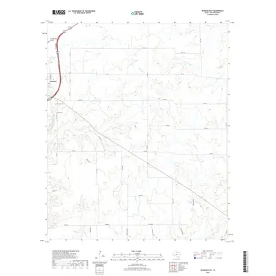
2019 Map of Seymour East
USGS Topo · Published 2019About this map
Seymour sits at the western edge of this 2019 survey, overlooking the winding path of the Brazos River. This corner of Baylor County is defined by a dense network of intermittent drainage systems, where the terrain is carved by Seymour Cr, Rock Cr, and Deep Cr. These waterways dictate the local infrastructure, with ranch roads and state highways like FM 422 and FM 1286 navigating the breaks and plateaus of the North Texas plains. For genealogists and local historians, the presence of Riverview Cem and Woodman Cem near the river bluffs provides specific points of interest for family research. The map illustrates a landscape primarily dedicated to agriculture and ranching, evidenced by numerous private ranch roads such as Two M Ranch Rd and Porter Rch Rd that connect isolated properties across the rolling landscape.
Find a feature on this map
38 named features on this map. Tap any name to fly to it.
Don’t see what you’re looking for? This feature index may not catch every label — zoom into the map to look around manually.
Map Details
Editions of this 2019 Seymour East Map
This is the sole edition of this map. No revisions or reprints were ever made.
Other maps of this area

1954 · Wichita Falls
USGS Topo · 1:250,000

1958 · Wichita Falls
USGS Topo · 1:250,000

1962 · Antelope Creek NE
USGS Topo · 1:24,000

1966 · Seymour West
USGS Topo · 1:24,000

1966 · Rock Canyon
USGS Topo · 1:24,000

1966 · Fulda
USGS Topo · 1:24,000

1966 · Southeast Lake Kemp
USGS Topo · 1:24,000

1966 · Southwest Lake Kemp
USGS Topo · 1:24,000

1966 · Seymour East
USGS Topo · 1:24,000
1966 · Cope Branch
USGS Topo · 1:24,000