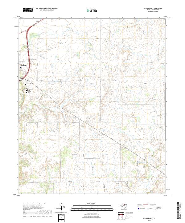
2022 Map of Seymour East
USGS Topo · Published 2022About this map
The Brazos River winds along the western edge of this Baylor County landscape, where the eastern reaches of Seymour transition into a vast network of creek drainages. A notable concentration of community history is preserved on the town's outskirts through several distinct burial grounds, including the Riverview Cem, Seymour Catholic Cem, Old Seymour Cem, Masonic Cem, Odd Fellows Cem, and Woodmen Cem. These sites provide significant genealogical value for those researching the early families of the region.
Find a feature on this map
42 named features on this map. Tap any name to fly to it.
Don’t see what you’re looking for? This feature index may not catch every label — zoom into the map to look around manually.
Map Details
Editions of this 2022 Seymour East Map
This is the sole edition of this map. No revisions or reprints were ever made.
Other maps of this area

1954 · Wichita Falls
USGS Topo · 1:250,000

1958 · Wichita Falls
USGS Topo · 1:250,000

1962 · Antelope Creek NE
USGS Topo · 1:24,000

1966 · Seymour West
USGS Topo · 1:24,000

1966 · Rock Canyon
USGS Topo · 1:24,000

1966 · Fulda
USGS Topo · 1:24,000

1966 · Southeast Lake Kemp
USGS Topo · 1:24,000

1966 · Southwest Lake Kemp
USGS Topo · 1:24,000

1966 · Seymour East
USGS Topo · 1:24,000
1966 · Cope Branch
USGS Topo · 1:24,000