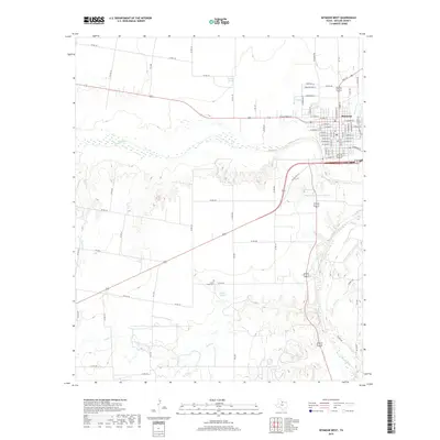
2019 Map of Seymour West
USGS Topo · Published 2019About this map
The Brazos River carves a wide path across this portion of Baylor County, creating a landscape defined by its riparian drainage network and the western edge of Seymour. This town serves as the primary hub, with a detailed street grid including W California St and N Main St extending toward the river's edge. The land south of the river is marked by several significant water features and tributaries, including Cache Cr, Polecat Cr, and Rock Cr, which drain into the main river valley.
Find a feature on this map
87 named features on this map. Tap any name to fly to it.
Don’t see what you’re looking for? This feature index may not catch every label — zoom into the map to look around manually.
Map Details
Editions of this 2019 Seymour West Map
This is the sole edition of this map. No revisions or reprints were ever made.
Other maps of this area

1954 · Wichita Falls
USGS Topo · 1:250,000

1958 · Wichita Falls
USGS Topo · 1:250,000

1962 · Antelope Creek NE
USGS Topo · 1:24,000

1962 · Antelope Creek NW
USGS Topo · 1:24,000

1966 · Seymour West
USGS Topo · 1:24,000

1966 · Rock Canyon
USGS Topo · 1:24,000

1966 · Soap Creek
USGS Topo · 1:24,000

1966 · Southeast Lake Kemp
USGS Topo · 1:24,000

1966 · Bomarton
USGS Topo · 1:24,000

1966 · Southwest Lake Kemp
USGS Topo · 1:24,000