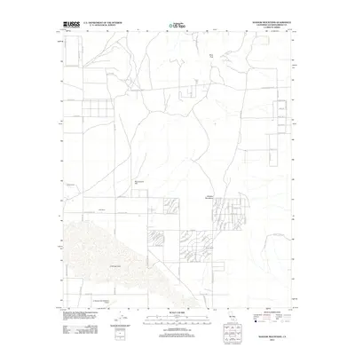
2012 Map of Shadow Mountains
USGS Topo · Published 2012About this map
El Mirage Lake dominates the southern portion of this high desert landscape, providing a distinctive geographic anchor for the region. The map reveals a transition from the vast alkali flat toward the higher elevations of Silver Peak and Resurrection Hill within the Shadow Mountains. Settlement patterns are defined by scattered ranching properties and a structured grid of residential streets south of the peaks, including neighborhoods near Gerrish Ranch.
Find a feature on this map
70 named features on this map. Tap any name to fly to it.
Don’t see what you’re looking for? This feature index may not catch every label — zoom into the map to look around manually.
Map Details
Editions of this 2012 Shadow Mountains Map
This is the sole edition of this map. No revisions or reprints were ever made.
Other maps of this area

1930 · El Mirage
USGS Topo · 1:24,000

1931 · Adobe
USGS Topo · 1:24,000

1932 · Barstow
USGS Topo · 1:125,000

1933 · El Mirage
USGS Topo · 1:24,000

1934 · Barstow
USGS Topo · 1:125,000

1934 · Adobe
USGS Topo · 1:24,000

1937 · Shadow Mountains
USGS Topo · 1:48,000

1937 · Kramer
USGS Topo · 1:48,000

1942 · Kramer
USGS Topo · 1:62,500

1942 · Shadow Mountains
USGS Topo · 1:62,500