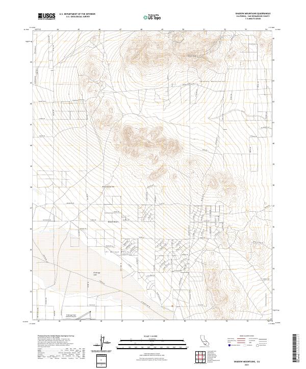
2021 Map of Shadow Mountains
USGS Topo · Published 2021About this map
Shadow Mountains and the northern reaches of the Mojave Desert define this high-desert terrain in San Bernardino County. In the early 2020s, the landscape is a grid of surveyed roads and isolated landmarks, including Silver Peak and Resurrection Hill. The southern portion of the map is dominated by the El Mirage Valley, home to the expansive dry bed of El Mirage Lake. This area is a focal point for aviation and recreation, anchored by the El Mirage Field Adelanto Airport. The map documents a sparse but deliberate network of local routes like Hess Ranch Rd and Sierra Rd that cut across the alluvial fans and volcanic outcroppings, illustrating the modern settlement patterns within this arid environment.
Find a feature on this map
88 named features on this map. Tap any name to fly to it.
Don’t see what you’re looking for? This feature index may not catch every label — zoom into the map to look around manually.
Map Details
Editions of this 2021 Shadow Mountains Map
This is the sole edition of this map. No revisions or reprints were ever made.
Other maps of this area

1930 · El Mirage
USGS Topo · 1:24,000

1931 · Adobe
USGS Topo · 1:24,000

1932 · Barstow
USGS Topo · 1:125,000

1933 · El Mirage
USGS Topo · 1:24,000

1934 · Barstow
USGS Topo · 1:125,000

1934 · Adobe
USGS Topo · 1:24,000

1937 · Shadow Mountains
USGS Topo · 1:48,000

1937 · Kramer
USGS Topo · 1:48,000

1942 · Kramer
USGS Topo · 1:62,500

1942 · Shadow Mountains
USGS Topo · 1:62,500