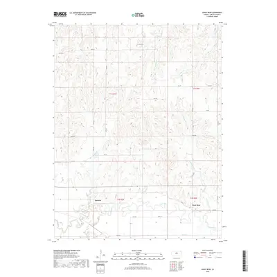
2018 Map of Shady Bend
USGS Topo · Published 2018About this map
The Saline River winds through the southern reaches of this Lincoln County landscape, defining the character of the small settlement at Shady Bend. In this section of central Kansas, the terrain is shaped by a dense network of tributaries, including Twelvemile Cr and Elkhorn Cr, which carve through the high ground north of the river valley. The map reveals a rural structure dictated by the Public Land Survey System, with a grid of gravel roads like 250th Rd and 270th Rd connecting isolated farmsteads.
Find a feature on this map
35 named features on this map. Tap any name to fly to it.
Don’t see what you’re looking for? This feature index may not catch every label — zoom into the map to look around manually.
Map Details
Editions of this 2018 Shady Bend Map
This is the sole edition of this map. No revisions or reprints were ever made.
Other maps of this area

1892 · Salina
USGS Topo · 1:125,000

1892 · Minneapolis
USGS Topo · 1:125,000

1894 · Ellsworth
USGS Topo · 1:125,000

1894 · Beloit
USGS Topo · 1:125,000

1942 · Salina
USGS Topo · 1:125,000

1955 · Manhattan
USGS Topo · 1:250,000

1955 · Great Bend
USGS Topo · 1:250,000

1955 · Hutchinson
USGS Topo · 1:250,000

1955 · Beloit
USGS Topo · 1:250,000

1956 · Manhattan
USGS Topo · 1:250,000