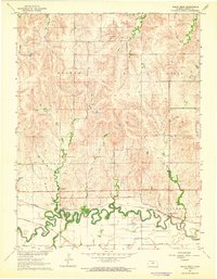
1963 Map of Shady Bend
USGS Topo · Published 1964About this map
The Saline River meanders through the southern portion of this Lincoln County landscape, creating a fertile valley where the settlement of Shady Bend took root. This mid-century survey illustrates a critical transport corridor where the Union Pacific and Atchison Topeka and Santa Fe railroads run parallel to the river's course, supporting the local agricultural and industrial economy. Family history and local heritage are preserved at the Sunnyside Cem and Shady Bend Cem, while the industrial character of the region is evidenced by numerous resource sites, including a Quartzite deposit and several gravel pits.
Find a feature on this map
16 named features on this map. Tap any name to fly to it.
Don’t see what you’re looking for? This feature index may not catch every label — zoom into the map to look around manually.
Map Details
Editions of this 1963 Shady Bend Map
This is the sole edition of this map. No revisions or reprints were ever made.
Other maps of this area

1892 · Salina
USGS Topo · 1:125,000

1892 · Minneapolis
USGS Topo · 1:125,000

1894 · Ellsworth
USGS Topo · 1:125,000

1894 · Beloit
USGS Topo · 1:125,000

1942 · Salina
USGS Topo · 1:125,000

1955 · Manhattan
USGS Topo · 1:250,000

1955 · Great Bend
USGS Topo · 1:250,000

1955 · Hutchinson
USGS Topo · 1:250,000

1955 · Beloit
USGS Topo · 1:250,000

1956 · Manhattan
USGS Topo · 1:250,000