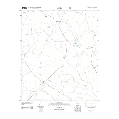
2011 Map of Shady Dale
USGS Topo · Published 2011About this map
Shady Dale and the nearby junction of Machen serve as the primary hubs in this Jasper County landscape, where the local road network connects small agricultural communities. The terrain is defined by the winding course of the Little River, which is fed by numerous tributaries including Gap Creek, Turkey Creek, and Hanna Branch. Human impact on the hydrology is evident in features like McComb Lake, Vason Lake, and Lynch Lake, created by dams that support local water management.
Find a feature on this map
48 named features on this map. Tap any name to fly to it.
Don’t see what you’re looking for? This feature index may not catch every label — zoom into the map to look around manually.
Map Details
Editions of this 2011 Shady Dale Map
This is the sole edition of this map. No revisions or reprints were ever made.
Other maps of this area

1896 · Monroe
USGS Topo · 1:125,000

1953 · Athens
USGS Topo · 1:250,000

1958 · Athens
USGS Topo · 1:250,000

1959 · Athens
USGS Topo · 1:250,000

1963 · Athens
USGS Topo · 1:250,000

1972 · Monticello
USGS Topo · 1:24,000

1972 · Eatonton
USGS Topo · 1:24,000

1972 · Shady Dale
USGS Topo · 1:24,000
1972 · Smithboro
USGS Topo · 1:24,000

1972 · Rock Eagle Lake
USGS Topo · 1:24,000