
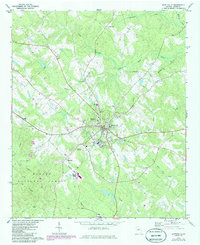
1972 Map of Monticello
USGS Topo · Published 1974About this map
Monticello serves as the central hub of Jasper County in the early 1970s, positioned at the convergence of several regional routes and the Georgia Central Railroad. The town is characterized by a concentrated grid of streets containing a Hospital, High School, and local cemeteries like West View Cem and South View Cem. To the west, the landscape transitions into the expansive Oconee National Forest, where smaller settlements and landmarks such as Mineta and Philadelphia Ch are scattered among the timberlands.
Find a feature on this map
35 named features on this map. Tap any name to fly to it.
Don’t see what you’re looking for? This feature index may not catch every label — zoom into the map to look around manually.
Map Details
Editions of this 1972 Monticello Map
2 editions found
Other maps of this area

1951 · Forsyth
USGS Topo · 1:62,500

1953 · Athens
USGS Topo · 1:250,000

1958 · Athens
USGS Topo · 1:250,000

1959 · Athens
USGS Topo · 1:250,000

1963 · Athens
USGS Topo · 1:250,000

1964 · Lloyd Shoals Dam
USGS Topo · 1:24,000

1964 · Stewart
USGS Topo · 1:24,000

1964 · Stanfordville
USGS Topo · 1:24,000

1964 · Hillsboro
USGS Topo · 1:24,000

1972 · Shady Dale
USGS Topo · 1:24,000