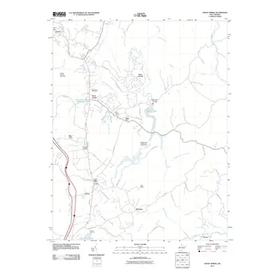
2011 Map of Shady Spring
USGS Topo · Published 2011About this map
Daniels Post Office and Shady Spring Post Office anchor a network of unincorporated communities along the ridge lines of Raleigh County. This upland landscape is defined by its water management systems, notably the Beckley Water Supply Number One Lake and the Glade Creek Reservoir Dam, which serve the growing residential clusters of Glade Springs and White Oak. The topography transitions from the heights of Shady Spring Mountain down to the Little Bluestone River at the southeastern edge, near the community of Streeter. Local recreation and community hubs are well-represented by the Lakeview Golf Course and the Crab Orchard Baptist Camp, illustrating the area's development as both a residential corridor and a highland retreat. A variety of smaller settlements like Cool Ridge and Cherry Creek are interconnected by winding mountain roads such as White Oak Mtn Rd and Fire Trail Rd.
Find a feature on this map
76 named features on this map. Tap any name to fly to it.
Don’t see what you’re looking for? This feature index may not catch every label — zoom into the map to look around manually.
Map Details
Editions of this 2011 Shady Spring Map
This is the sole edition of this map. No revisions or reprints were ever made.
Other maps of this area

1887 · Hinton
USGS Topo · 1:125,000

1891 · Raleigh
USGS Topo · 1:125,000

1892 · Hinton
USGS Topo · 1:125,000

1897 · Raleigh
USGS Topo · 1:125,000

1902 · Raleigh
USGS Topo · 1:125,000

1911 · Flattop
USGS Topo · 1:48,000

1911 · Beckley
USGS Topo · 1:48,000

1912 · Meadow Creek
USGS Topo · 1:48,000

1912 · Big Bend
USGS Topo · 1:62,500

1913 · Beckley
USGS Topo · 1:62,500