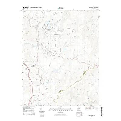
2014 Map of Shady Spring
USGS Topo · Published 2014About this map
Shady Spring and the neighboring residential developments of Glade Springs characterize this portion of Raleigh County during the early 21st century. The landscape is defined by the transition from established settlements like White Oak and Cool Ridge to modern recreational expansions, most notably the several golf courses at The Resort at Glade Springs. Water management is a central theme, with the Beckly Water Supply Number One Lake and Little Beaver Lake providing critical infrastructure and leisure space for the community. In the southern portion of the map, the terrain descends toward the Little Bluestone River, where the settlement of Streeter sits near the county line. This map documents a period of significant suburban and resort-style growth, while maintaining the traditional Appalachian character through features like Joes Ridge and Shady Spring Mtn.
Find a feature on this map
140 named features on this map. Tap any name to fly to it.
Don’t see what you’re looking for? This feature index may not catch every label — zoom into the map to look around manually.
Map Details
Editions of this 2014 Shady Spring Map
This is the sole edition of this map. No revisions or reprints were ever made.
Other maps of this area

1887 · Hinton
USGS Topo · 1:125,000

1891 · Raleigh
USGS Topo · 1:125,000

1892 · Hinton
USGS Topo · 1:125,000

1897 · Raleigh
USGS Topo · 1:125,000

1902 · Raleigh
USGS Topo · 1:125,000

1911 · Flattop
USGS Topo · 1:48,000

1911 · Beckley
USGS Topo · 1:48,000

1912 · Meadow Creek
USGS Topo · 1:48,000

1912 · Big Bend
USGS Topo · 1:62,500

1913 · Beckley
USGS Topo · 1:62,500