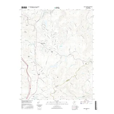
2016 Map of Shady Spring
USGS Topo · Published 2016About this map
The mountain settlements of Shady Spring and Cool Ridge anchor this detailed study of the Appalachian highlands along the Raleigh and Summers county line. The landscape is defined by the high ridges of Shady Spring Mtn and White Oak Mtn, which frame a complex network of headwaters including Glade Cr and the Little Bluestone River. Significant water management features, such as the Beckley Water Supply Number One Lake and Glade Cr Reservoir, demonstrate the infrastructure supporting these growing residential communities. A network of recreational paths, including the Beaver Creek Trail and Railroad Grade Trail, winds through the northern portion of the map near Little Beaver Lake. These trails, combined with the established road networks of Ghent and Daniels, reveal a modern era where old mountain passes have transitioned into vital transportation and recreational corridors.
Find a feature on this map
146 named features on this map. Tap any name to fly to it.
Don’t see what you’re looking for? This feature index may not catch every label — zoom into the map to look around manually.
Map Details
Editions of this 2016 Shady Spring Map
This is the sole edition of this map. No revisions or reprints were ever made.
Other maps of this area

1887 · Hinton
USGS Topo · 1:125,000

1891 · Raleigh
USGS Topo · 1:125,000

1892 · Hinton
USGS Topo · 1:125,000

1897 · Raleigh
USGS Topo · 1:125,000

1902 · Raleigh
USGS Topo · 1:125,000

1911 · Flattop
USGS Topo · 1:48,000

1911 · Beckley
USGS Topo · 1:48,000

1912 · Meadow Creek
USGS Topo · 1:48,000

1912 · Big Bend
USGS Topo · 1:62,500

1913 · Beckley
USGS Topo · 1:62,500