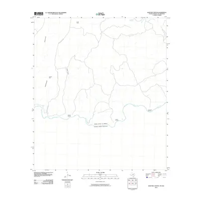
2010 Map of Shafter Canyon
USGS Topo · Published 2010About this map
The Rio Grande serves as the international boundary on this desert landscape, separating the United States of America from Estados Unidos Mexicanos. The map documents a sparse, arid region defined by deep drainage networks and rugged elevations such as Shafter Hills and the prominent Shafter Canyon. While the area is largely uninhabited, historical transit points across the river remain vital, including Santa Rosa Crossing and El Moro Crossing.
Find a feature on this map
15 named features on this map. Tap any name to fly to it.
Don’t see what you’re looking for? This feature index may not catch every label — zoom into the map to look around manually.
Map Details
Editions of this 2010 Shafter Canyon Map
This is the sole edition of this map. No revisions or reprints were ever made.
Other maps of this area

1918 · Dryden Crossing
USGS Topo · 1:62,500

1943 · Malvado
USGS Topo · 1:62,500

1944 · Malvado
USGS Topo · 1:62,500

1958 · Del Rio
USGS Topo · 1:250,000

1959 · Emory Peak
USGS Topo · 1:250,000

1964 · Del Rio
USGS Topo · 1:250,000

1965 · Emory Peak
USGS Topo · 1:250,000
1979 · Cook Creek North
USGS Topo · 1:24,000
1979 · Cook Creek South
USGS Topo · 1:24,000
1983 · Balcon Creek
USGS Topo · 1:24,000