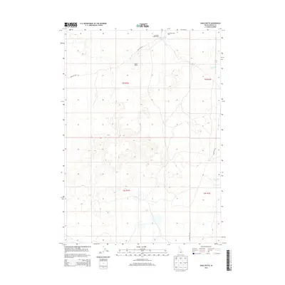
2013 Map of Shale Butte
USGS Topo · Published 2013About this map
Shale Butte dominates this high desert landscape in Lincoln County, where the topography is defined by scattered ephemeral water bodies and isolated structures. Evidence of seasonal use or historical habitation appears at the Shale Butte Trappers Cabin, located in the north near the Shale Butte Water Tank. The area is traversable via unimproved routes like Shale Butte Rd and Kimama Cave Rd, which navigate a terrain marked by numerous small depressions and basins. These basins occasionally collect water, forming features such as Mustard Lake, Cottontail Lake, and Shale Butte Lake. The map illustrates a largely unpopulated portion of Idaho, organized under the Public Land Survey System as townships t5s r22e and t6s r22e, reflecting a geography that remains primarily open range.
Find a feature on this map
13 named features on this map. Tap any name to fly to it.
Don’t see what you’re looking for? This feature index may not catch every label — zoom into the map to look around manually.
Map Details
Editions of this 2013 Shale Butte Map
This is the sole edition of this map. No revisions or reprints were ever made.
Other maps of this area

1954 · Pocatello
USGS Topo · 1:250,000

1955 · Idaho Falls
USGS Topo · 1:250,000

1958 · Idaho Falls
USGS Topo · 1:250,000

1958 · Pocatello
USGS Topo · 1:250,000

1972 · Shale Butte
USGS Topo · 1:24,000

1972 · Kimama
USGS Topo · 1:24,000
1972 · Kimama Butte
USGS Topo · 1:24,000

1972 · Community Lake
USGS Topo · 1:24,000

1972 · Laidlaw Lake
USGS Topo · 1:24,000
1972 · Senter
USGS Topo · 1:24,000