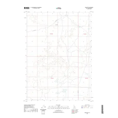
2020 Map of Shale Butte
USGS Topo · Published 2020About this map
Shale Butte rises as a prominent landmark in this desert landscape of Lincoln County, defined by its volcanic topography and a network of ephemeral water bodies. This 2020 survey captures a region where seasonal moisture accumulates in depressions such as Mustard Lake, Cottontail Lake, and Shale Butte Lake, which sit northwest of the larger New Road Lake. Access across the high desert is maintained by a few established routes, primarily Shale Butte Rd and Kimama Cave Rd, which navigate the township and range grids of the Snake River Plain. The map illustrates a landscape of lava-formed terrain where small basins and ridges dictate the placement of local roads and the few reliable catchment points for water.
Find a feature on this map
11 named features on this map. Tap any name to fly to it.
Don’t see what you’re looking for? This feature index may not catch every label — zoom into the map to look around manually.
Map Details
Editions of this 2020 Shale Butte Map
This is the sole edition of this map. No revisions or reprints were ever made.
Other maps of this area

1954 · Pocatello
USGS Topo · 1:250,000

1955 · Idaho Falls
USGS Topo · 1:250,000

1958 · Idaho Falls
USGS Topo · 1:250,000

1958 · Pocatello
USGS Topo · 1:250,000

1972 · Shale Butte
USGS Topo · 1:24,000

1972 · Kimama
USGS Topo · 1:24,000
1972 · Kimama Butte
USGS Topo · 1:24,000

1972 · Community Lake
USGS Topo · 1:24,000

1972 · Laidlaw Lake
USGS Topo · 1:24,000
1972 · Senter
USGS Topo · 1:24,000