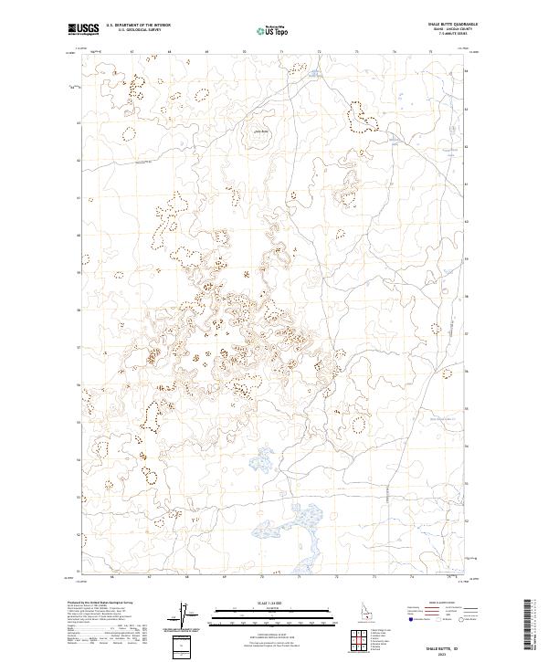
2023 Map of Shale Butte
USGS Topo · Published 2023About this map
Shale Butte rises as the central landmark of this high desert terrain in Lincoln County, anchoring a landscape defined by seasonal water and volcanic features. The survey documents a network of shallow desert basins, including Shale Butte Lake to the north and Mustard Lake and Cottontail Lake situated further east. These ephemeral water sources are critical features in an otherwise arid expanse, likely serving as historic watering points for livestock and wildlife.
Find a feature on this map
11 named features on this map. Tap any name to fly to it.
Don’t see what you’re looking for? This feature index may not catch every label — zoom into the map to look around manually.
Map Details
Editions of this 2023 Shale Butte Map
This is the sole edition of this map. No revisions or reprints were ever made.
Other maps of this area

1954 · Pocatello
USGS Topo · 1:250,000

1955 · Idaho Falls
USGS Topo · 1:250,000

1958 · Idaho Falls
USGS Topo · 1:250,000

1958 · Pocatello
USGS Topo · 1:250,000

1972 · Shale Butte
USGS Topo · 1:24,000

1972 · Kimama
USGS Topo · 1:24,000
1972 · Kimama Butte
USGS Topo · 1:24,000

1972 · Community Lake
USGS Topo · 1:24,000

1972 · Laidlaw Lake
USGS Topo · 1:24,000
1972 · Senter
USGS Topo · 1:24,000