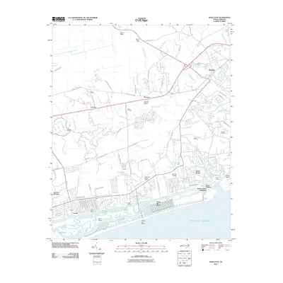
2010 Map of Shallotte
USGS Topo · Published 2010About this map
Ocean Isle Beach and its surrounding coastal wetlands define this Brunswick County landscape at the turn of the 21st century. The map illustrates a complex network of coastal waterways, where the Shallotte River flows toward the Atlantic Ocean past Brantley Island and Sols Island. Inland, the area shows a transition from traditional family-named landmarks like Mintz Cemetery and Parker Cemetery to modern coastal developments such as Sea Trail Plantation and Brick Landing Plantation. This era is marked by the expansion of maritime infrastructure, including the Pelican Pointe Marina and Ocean Isle Beach Airport. Further North, the terrain becomes more wooded and swampy, characterized by the McMilly Swamp and Cawcaw Swamp, while the town of Shallotte serves as a regional hub. Local history is grounded in specific sites like Gause Landing and the Shallotte Lookout Tower, providing a clear view of the region's evolving land use from agricultural roots to a coastal recreational economy.
Find a feature on this map
81 named features on this map. Tap any name to fly to it.
Don’t see what you’re looking for? This feature index may not catch every label — zoom into the map to look around manually.
Map Details
Editions of this 2010 Shallotte Map
This is the sole edition of this map. No revisions or reprints were ever made.
Other maps of this area

1943 · Little River
USGS Topo · 1:31,680

1943 · Calabash
USGS Topo · 1:31,680

1943 · Freeland
USGS Topo · 1:24,000

1943 · Holden Beach
USGS Topo · 1:24,000

1943 · Exum
USGS Topo · 1:24,000

1943 · Supply
USGS Topo · 1:24,000

1943 · Shallotte
USGS Topo · 1:24,000

1944 · Supply
USGS Topo · 1:31,680

1944 · Shallotte
USGS Topo · 1:31,680

1949 · Georgetown
USGS Topo · 1:250,000