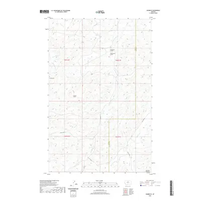
2020 Map of Shambo SE
USGS Topo · Published 2020About this map
Bears Paw Mountains define the southern reaches of this landscape, where the high elevation peaks like Mt Reynolds overlook a complex network of drainages and coulees. The terrain is deeply incised by seasonal and perennial waters, including Little Boxelder Cr and Sucker Cr, which flow through the high plains of the Hill and Blaine County border region. This area remains largely defined by its topography and the cattle-grazing infrastructure of the contemporary West.
Find a feature on this map
20 named features on this map. Tap any name to fly to it.
Don’t see what you’re looking for? This feature index may not catch every label — zoom into the map to look around manually.
Map Details
Editions of this 2020 Shambo SE Map
This is the sole edition of this map. No revisions or reprints were ever made.
Other maps of this area

1953 · Havre
USGS Topo · 1:250,000

1956 · Maddux
USGS Topo · 1:62,500

1956 · Lloyd
USGS Topo · 1:62,500

1957 · Havre
USGS Topo · 1:250,000

1958 · Havre
USGS Topo · 1:250,000

1959 · Warrick
USGS Topo · 1:62,500

1959 · Shambo
USGS Topo · 1:62,500
1984 · Bearpaw Lake
USGS Topo · 1:24,000
1984 · Shambo NE
USGS Topo · 1:24,000

1984 · Big John Butte
USGS Topo · 1:24,000