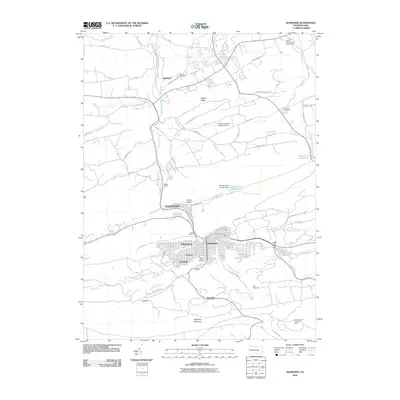
2010 Map of Shamokin
USGS Topo · Published 2010About this map
Shamokin sits at the heart of this anthracite region survey, where the dense urban grid of the city meets the surrounding coal-country valleys. The landscape is defined by its deep industrial roots, visible in the cluster of neighborhoods like Fairview, Ferndale, and Edgewood that ring the city center. Along the southern edge, the formidable slopes of Mahanoy Mountain and Big Mountain separate the urban area from smaller settlements such as Burnside.
Find a feature on this map
59 named features on this map. Tap any name to fly to it.
Don’t see what you’re looking for? This feature index may not catch every label — zoom into the map to look around manually.
Map Details
Editions of this 2010 Shamokin Map
This is the sole edition of this map. No revisions or reprints were ever made.
Other maps of this area

1889 · Catawissa
USGS Topo · 1:62,500

1892 · Catawissa
USGS Topo · 1:62,500

1892 · Lykens
USGS Topo · 1:62,500

1892 · Shamokin
USGS Topo · 1:62,500

1892 · Pine Grove
USGS Topo · 1:62,500

1893 · Lykens
USGS Topo · 1:62,500

1893 · Shamokin
USGS Topo · 1:62,500

1894 · Catawissa
USGS Topo · 1:62,500

1943 · Lykens
USGS Topo · 1:62,500

1943 · Shamokin
USGS Topo · 1:62,500
Featured Places
- Shamokin, PA
- Elysburg, Ralpho Township
- West Cameron Township, PA
- East Cameron Township, PA
- Point Breeze, East Cameron Township