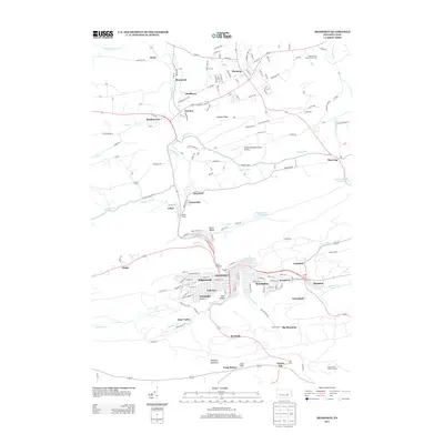
2013 Map of Shamokin
USGS Topo · Published 2013About this map
Shamokin anchors this 2013 survey of Pennsylvania’s anthracite region, where the street grids of Edgewood, Fairview, and Ferndale follow the narrow valley of Shamokin Creek. The map details a landscape shaped by coal geography, from the ridges of Mahanoy Mountain and Big Mountain to the clustered settlements of Coal Run, Ranshaw, and Greenback. Unlike the tightly packed boroughs to the south, the northern half of the quadrangle opens into the more rolling terrain around Elysburg and Paxinos, where the Northumberland County Airport and Jepkos Three Ponds Golf Course mark contemporary land use. Significant industrial markers like the Weigh Scales near Cabel and the Boyers Knob Lookout Tower to the southeast provide specific reference points for local history. Waterways such as Millers Run and Carbon Run define the drainage patterns between the high ridges like Whaleback, illustrating the corridor's unique physical and social orientation.
Find a feature on this map
99 named features on this map. Tap any name to fly to it.
Don’t see what you’re looking for? This feature index may not catch every label — zoom into the map to look around manually.
Map Details
Editions of this 2013 Shamokin Map
This is the sole edition of this map. No revisions or reprints were ever made.
Other maps of this area

1889 · Catawissa
USGS Topo · 1:62,500

1892 · Catawissa
USGS Topo · 1:62,500

1892 · Lykens
USGS Topo · 1:62,500

1892 · Shamokin
USGS Topo · 1:62,500

1892 · Pine Grove
USGS Topo · 1:62,500

1893 · Lykens
USGS Topo · 1:62,500

1893 · Shamokin
USGS Topo · 1:62,500

1894 · Catawissa
USGS Topo · 1:62,500

1943 · Lykens
USGS Topo · 1:62,500

1943 · Shamokin
USGS Topo · 1:62,500
Featured Places
- Shamokin, PA
- Elysburg, Ralpho Township
- West Cameron Township, PA
- East Cameron Township, PA
- Point Breeze, East Cameron Township