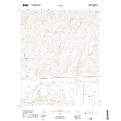
2018 Map of Shandon
USGS Topo · Published 2018About this map
Shandon sits at the intersection of California’s agricultural landscape and the winding drainage systems of San Luis Obispo County. The community and nearby Shandon Flat are anchored by the Estrella River, which creates a prominent topographical break as it flows westward through Yokum Bend. The landscape is defined by an intricate network of drainages, including McMillan Canyon, Shimmin Canyon, and Shedd Canyon, which reveal the area’s complex erosion patterns and water management history. Numerous water sources such as Lyon Spring, Morgenson Springs, and West Tuley Springs are scattered throughout the northern hills, indicating the critical role of groundwater in this semi-arid region. In the town center, Clark Memorial Park serves as a localized landmark, while the surrounding grid of roads like Starkey Rd and Truesdale Rd shows the transition from a concentrated settlement to broad ranching or farming plots.
Find a feature on this map
41 named features on this map. Tap any name to fly to it.
Don’t see what you’re looking for? This feature index may not catch every label — zoom into the map to look around manually.
Map Details
Editions of this 2018 Shandon Map
This is the sole edition of this map. No revisions or reprints were ever made.
Other maps of this area

1914 · Cholame
USGS Topo · 1:125,000

1915 · Cholame
USGS Topo · 1:125,000

1917 · Cholame
USGS Topo · 1:125,000

1919 · San Miguel
USGS Topo · 1:62,500

1919 · Paso Robles
USGS Topo · 1:62,500

1943 · Shandon
USGS Topo · 1:31,680

1943 · Paso Robles
USGS Topo · 1:62,500

1943 · Commatti Canyon
USGS Topo · 1:31,680
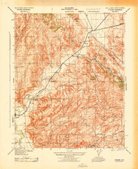
1943 · Cholame
USGS Topo · 1:31,680

1943 · Shedd Canyon
USGS Topo · 1:31,680