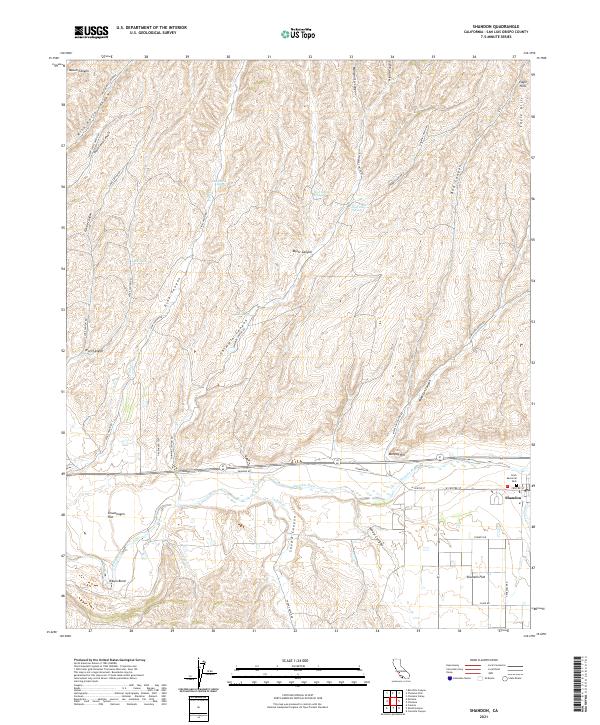
2021 Map of Shandon
USGS Topo · Published 2021About this map
The settlement of Shandon sits at the confluence of the Estrella River, Indian Cr, and San Juan Cr, serving as a central point in this San Luis Obispo County landscape. This 2021 survey shows a community defined by its water sources and topography, from the developed streets around W Centre St and Clark Memorial Park to the broader agricultural reaches of Shandon Flat. The surrounding terrain is heavily dissected by numerous canyons, including the significant McMillan Canyon and Taylor Canyon, which drain into the river valley.
Find a feature on this map
40 named features on this map. Tap any name to fly to it.
Don’t see what you’re looking for? This feature index may not catch every label — zoom into the map to look around manually.
Map Details
Editions of this 2021 Shandon Map
This is the sole edition of this map. No revisions or reprints were ever made.
Other maps of this area

1914 · Cholame
USGS Topo · 1:125,000

1915 · Cholame
USGS Topo · 1:125,000

1917 · Cholame
USGS Topo · 1:125,000

1919 · San Miguel
USGS Topo · 1:62,500

1919 · Paso Robles
USGS Topo · 1:62,500

1943 · Shandon
USGS Topo · 1:31,680

1943 · Paso Robles
USGS Topo · 1:62,500

1943 · Commatti Canyon
USGS Topo · 1:31,680
1943 · Cholame
USGS Topo · 1:31,680

1943 · Shedd Canyon
USGS Topo · 1:31,680