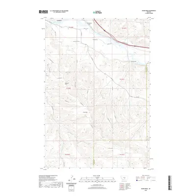
2020 Map of Shane Ridge
USGS Topo · Published 2020About this map
Columbus anchors the northern edge of this Montana landscape where the Yellowstone River cuts through the high plains. The topography is defined by significant elevation changes, moving from the river valley and Countrymans Bluff up toward the prominent Shane Ridge in the south. The map documents a rugged drainage network including Bearpaw Cr, Butt Cr, and the deep incision of Coal Mine Coulee. Landforms such as Wash Bowl Butte and Flaherty Flat indicate a landscape shaped by both wind and water erosion over time. Modern infrastructure, represented by Stillwater Estates Rd and several private ranch roads like Stadel Ln and Jack Rabbit Ln, shows the continued human expansion into the benchlands overlooking the river. The boundary between Stillwater and Carbon counties is also clearly delineated as it traverses these coulees and ridges.
Find a feature on this map
44 named features on this map. Tap any name to fly to it.
Don’t see what you’re looking for? This feature index may not catch every label — zoom into the map to look around manually.
Map Details
Editions of this 2020 Shane Ridge Map
This is the sole edition of this map. No revisions or reprints were ever made.
Other maps of this area

1892 · Stillwater
USGS Topo · 1:125,000

1932 · Red Lodge No 2
USGS Topo · 1:48,000

1932 · Red Lodge No 1
USGS Topo · 1:48,000

1954 · Billings
USGS Topo · 1:250,000

1955 · Whitebird School
USGS Topo · 1:24,000

1956 · Columbus West
USGS Topo · 1:24,000

1956 · Shane Ridge
USGS Topo · 1:24,000

1956 · Horse Butte
USGS Topo · 1:24,000

1956 · Columbus East
USGS Topo · 1:24,000

1956 · Roscoe NE
USGS Topo · 1:24,000