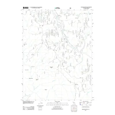
2012 Map of Shannon Butte
USGS Topo · Published 2012About this map
Shannon Butte and the surrounding high country of Trinity County define this 2012 survey, where the drainages of the Mad River and the N Fork Eel River intersect. The landscape is characterized by a network of forest routes and named "Places" that suggest a long history of family holdings and ranching, such as Crabtree Place, Russ Place, and Yellowjacket Place. These scattered settlements, alongside the Double A Ranch, indicate the persistent use of these remote flats and gulches for livestock or timber management long into the modern era.
Find a feature on this map
47 named features on this map. Tap any name to fly to it.
Don’t see what you’re looking for? This feature index may not catch every label — zoom into the map to look around manually.
Map Details
Editions of this 2012 Shannon Butte Map
This is the sole edition of this map. No revisions or reprints were ever made.
Other maps of this area

1918 · Anada
USGS Topo · 1:62,500

1921 · Hoaglin
USGS Topo · 1:62,500

1922 · Island Mountain
USGS Topo · 1:62,500

1931 · Hoaglin
USGS Topo · 1:96,000

1935 · Hoaglin
USGS Topo · 1:125,000

1953 · Blackrock Mtn
USGS Topo · 1:62,500

1954 · Pickett Peak
USGS Topo · 1:62,500

1954 · Dubakella Mtn
USGS Topo · 1:62,500

1954 · Blackrock Mtn
USGS Topo · 1:62,500
1955 · Kettenpom
USGS Topo · 1:62,500