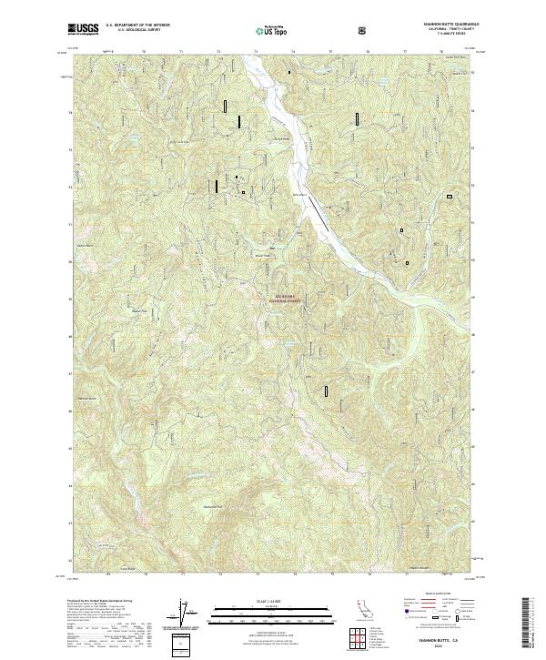
2022 Map of Shannon Butte
USGS Topo · Published 2022About this map
Mad River Ridge dominates the central topography of this section of the Six Rivers National Forest, where the landscape is defined by the winding course of the Mad River. The presence of the Ruth Airport along Mad River Road highlights the modern infrastructure supporting this remote area. To the southwest, the Eel Wild and Scenic River carves through the terrain, separated from the Mad River watershed by high points like Shannon Butte and Smith Peak. Several flatlands, including Packwood Flat, Raglan Flat, and Maple Flat, suggest pockets of level ground amidst the steep drainages of Raglan Gulch and Secret Gulch. The map captures a transition between protected forest lands and the complex river systems of Trinity County, featuring numerous springs such as Surveyor Spring and Wiregrass Spring that feed the local creeks.
Find a feature on this map
58 named features on this map. Tap any name to fly to it.
Don’t see what you’re looking for? This feature index may not catch every label — zoom into the map to look around manually.
Map Details
Editions of this 2022 Shannon Butte Map
This is the sole edition of this map. No revisions or reprints were ever made.
Other maps of this area

1918 · Anada
USGS Topo · 1:62,500

1921 · Hoaglin
USGS Topo · 1:62,500

1922 · Island Mountain
USGS Topo · 1:62,500

1931 · Hoaglin
USGS Topo · 1:96,000

1935 · Hoaglin
USGS Topo · 1:125,000

1953 · Blackrock Mtn
USGS Topo · 1:62,500

1954 · Pickett Peak
USGS Topo · 1:62,500

1954 · Dubakella Mtn
USGS Topo · 1:62,500

1954 · Blackrock Mtn
USGS Topo · 1:62,500
1955 · Kettenpom
USGS Topo · 1:62,500