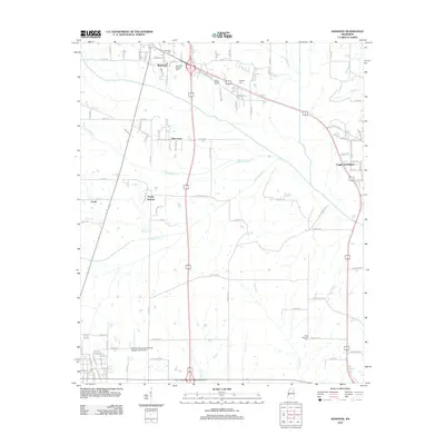
2012 Map of Shannon
USGS Topo · Published 2012About this map
Shannon serves as the primary population center in this part of northeastern Mississippi, where a network of rural roads connects established communities like Pine Grove and Poplar Springs. The landscape is defined by its complex drainage system, featuring winding watercourses such as Tubbalubba Cr, Chiwapa Cr, and Tallabinnela Cr that crisscross the agricultural terrain. For genealogists and local historians, the map identifies several significant burial sites, including the Whiteside (Family) Cem and New Prospect Cem, alongside the shared grounds of Dotys Chapel Cem and Temples Cem. Aviation history is represented by the Okolona Municipal-Richard Stovall Field Airport in the southern portion of the sheet. The area's transport evolution is evident in the transition from local routes to larger thoroughfares like Old Highway 45, which bypasses the older residential cores.
Find a feature on this map
115 named features on this map. Tap any name to fly to it.
Don’t see what you’re looking for? This feature index may not catch every label — zoom into the map to look around manually.
Map Details
Editions of this 2012 Shannon Map
This is the sole edition of this map. No revisions or reprints were ever made.
Other maps of this area

1953 · West Point
USGS Topo · 1:250,000

1956 · Tupelo
USGS Topo · 1:250,000

1958 · Tupelo
USGS Topo · 1:250,000

1958 · West Point
USGS Topo · 1:250,000

1959 · Van Vleet
USGS Topo · 1:62,500

1963 · West Point
USGS Topo · 1:250,000

1965 · Egypt
USGS Topo · 1:24,000

1966 · Shannon
USGS Topo · 1:24,000

1966 · Wren
USGS Topo · 1:24,000
1966 · Nettleton
USGS Topo · 1:24,000