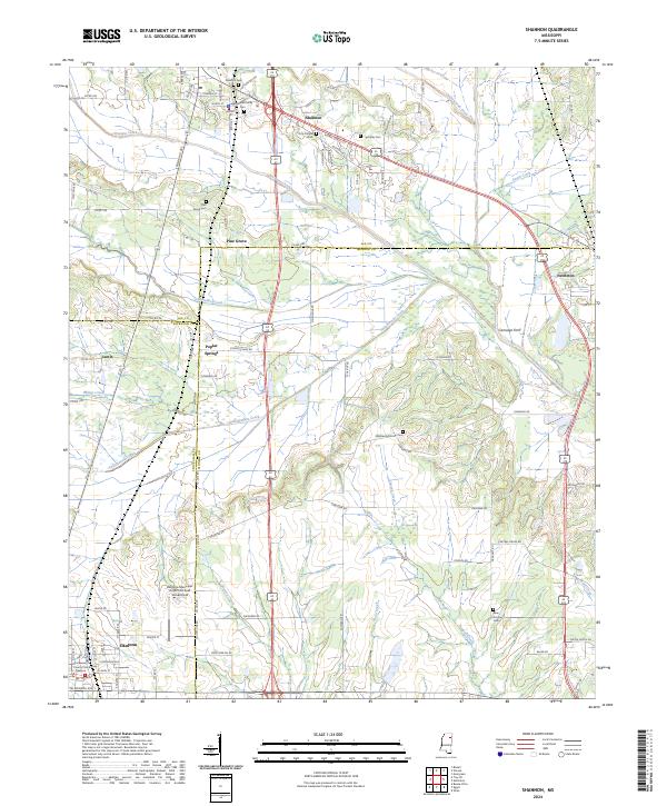
2024 Map of Shannon
USGS Topo · Published 2024About this map
Shannon and Okolona anchor this topographic view of the north Mississippi landscape, where the borders of Lee, Monroe, and Chickasaw Counties converge. The region is defined by a complex drainage network that includes the winding paths of Chiwapa Creek, Tubbalubba Creek, and Tallabinnela Creek. These waterways historicaly shaped the settlement patterns of the area, evidenced by the scattered locations of smaller communities like Pine Grove, Poplar Springs, and Leotis.
Find a feature on this map
96 named features on this map. Tap any name to fly to it.
Don’t see what you’re looking for? This feature index may not catch every label — zoom into the map to look around manually.
Map Details
Editions of this 2024 Shannon Map
This is the sole edition of this map. No revisions or reprints were ever made.
Other maps of this area

1953 · West Point
USGS Topo · 1:250,000

1956 · Tupelo
USGS Topo · 1:250,000

1958 · Tupelo
USGS Topo · 1:250,000

1958 · West Point
USGS Topo · 1:250,000

1959 · Van Vleet
USGS Topo · 1:62,500

1963 · West Point
USGS Topo · 1:250,000

1965 · Egypt
USGS Topo · 1:24,000

1966 · Shannon
USGS Topo · 1:24,000

1966 · Wren
USGS Topo · 1:24,000
1966 · Nettleton
USGS Topo · 1:24,000