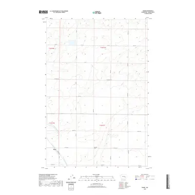
2020 Map of Shano
USGS Topo · Published 2020About this map
Shano sits at the intersection of rural thoroughfares in this modern-era study of the Washington wheat country. The landscape is defined by the agricultural engineering of the Columbia Basin Project, prominently featuring the East Low Canal and the Scooteney Wasteway. These water systems cut across the undulating terrain of Paradise Flats, illustrating the intricate irrigation network that transformed the high desert. The grid of roads, including Gearhardt Rd and W Hatton Rd, serves a sparsely populated region of Adams County where large-scale farming dominates the local economy. Property boundaries like t16n r31e provide a clear view of the Public Land Survey System as it persists into the twenty-first century.
Find a feature on this map
22 named features on this map. Tap any name to fly to it.
Don’t see what you’re looking for? This feature index may not catch every label — zoom into the map to look around manually.
Map Details
Editions of this 2020 Shano Map
This is the sole edition of this map. No revisions or reprints were ever made.
Other maps of this area

1916 · Connell
USGS Topo · 1:125,000

1918 · Connell
USGS Topo · 1:125,000

1924 · Othello
USGS Topo · 1:62,500

1925 · Scooteney Lake
USGS Topo · 1:62,500

1951 · Scooteney Lake
USGS Topo · 1:62,500

1953 · Walla Walla
USGS Topo · 1:250,000

1954 · Bruce
USGS Topo · 1:24,000

1954 · Warden
USGS Topo · 1:24,000

1954 · Othello
USGS Topo · 1:62,500

1958 · Walla Walla
USGS Topo · 1:250,000