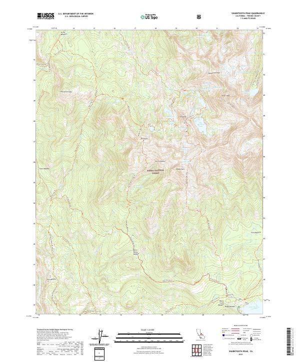
2021 Map of Sharktooth Peak
USGS Topo · Published 2021About this map
Sharktooth Peak and the high ridges of the Silver Divide dominate this 2021 landscape within the Sierra National Forest. The map detail reveals a high-altitude wilderness defined by glacial cirques and dozens of alpine water bodies, including Big Margaret Lake, Sharktooth Lake, and the uniquely named Useless Lake. The southern edge of the quadrangle is anchored by the northern reaches of Lake Thomas A Edison, a reservoir formed near the S Fork San Joaquin River. A network of backcountry routes, such as the California Riding And Hiking Trl and the Onion Springs Trl, provides the primary means of navigating this steep terrain. Landforms like Pincushion Peak and Saddle Mtn overlook numerous meadows, including Onion Spring Meadow and Fawn Meadow, which interrupt the granite and forest cover of the Sierra Nevada.
Find a feature on this map
66 named features on this map. Tap any name to fly to it.
Don’t see what you’re looking for? This feature index may not catch every label — zoom into the map to look around manually.
Map Details
Editions of this 2021 Sharktooth Peak Map
This is the sole edition of this map. No revisions or reprints were ever made.
Other maps of this area

1901 · Mt. Lyell
USGS Topo · 1:125,000

1904 · Kaiser
USGS Topo · 1:125,000

1912 · Mt. Goddard
USGS Topo · 1:125,000

1914 · Mt. Morrison
USGS Topo · 1:125,000

1947 · Mariposa
USGS Topo · 1:250,000

1948 · Mariposa
USGS Topo · 1:250,000

1953 · Mt. Morrison
USGS Topo · 1:62,500

1953 · Mt Abbot
USGS Topo · 1:62,500

1953 · Devils Postpile
USGS Topo · 1:62,500

1953 · Kaiser Peak
USGS Topo · 1:62,500