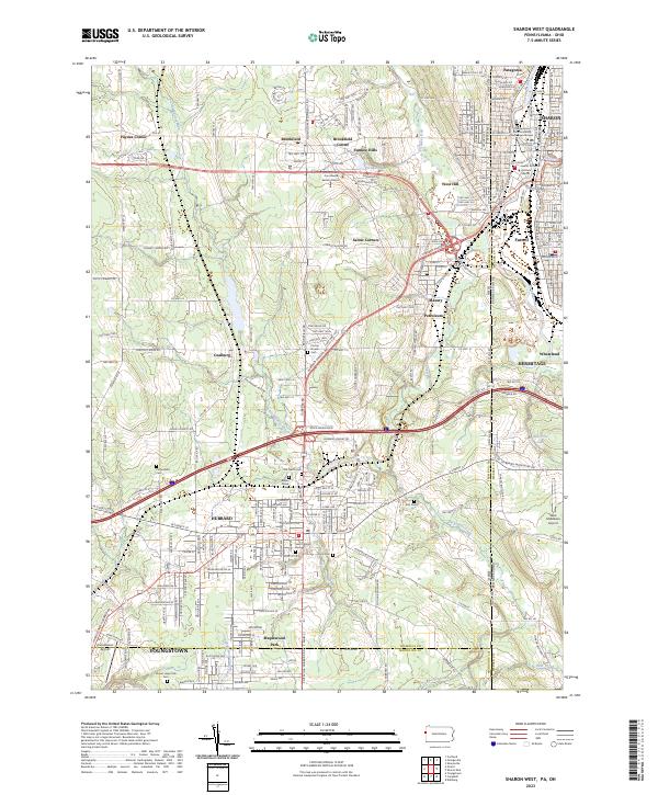
2023 Map of Sharon West
USGS Topo · Published 2023About this map
The Ohio-Pennsylvania state line bisects this landscape, separating the dense industrial and urban corridors of Sharon and Farrell from the more open terrain of Trumbull County. The Shenango River anchors the eastern edge, where the Pennsylvania State University Shenango Campus and Laurel Technical Institute Sharon sit amidst a grid of city streets like W State St and E Budd St. To the west, the landscape transitions into smaller settlements and distinct crossroads such as Brookfield Center, which houses the Trumbull County Courthouse - Eastern District.
Find a feature on this map
51 named features on this map. Tap any name to fly to it.
Don’t see what you’re looking for? This feature index may not catch every label — zoom into the map to look around manually.
Map Details
Editions of this 2023 Sharon West Map
This is the sole edition of this map. No revisions or reprints were ever made.
Other maps of this area

1905 · Neshannock
USGS Topo · 1:62,500

1906 · Youngstown
USGS Topo · 1:62,500

1907 · Neshannock
USGS Topo · 1:62,500

1907 · Kinsman
USGS Topo · 1:62,500

1908 · Shenango
USGS Topo · 1:62,500

1908 · Youngstown
USGS Topo · 1:62,500

1950 · Cleveland
USGS Topo · 1:250,000

1951 · Campbell
USGS Topo · 1:24,000

1951 · Youngstown
USGS Topo · 1:24,000

1954 · Sharon West
USGS Topo · 1:24,000