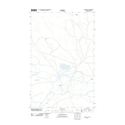
2011 Map of Sharp Lake
USGS Topo · Published 2011About this map
Nightshoot Cemetery serves as a quiet landmark in this high plains landscape of Glacier County, situated south of the namesake Sharp Lake. The area's geography is defined by a series of branching waterways, including Cut Bank Creek and its complex tributaries such as Greasewood Creek, North Fork Greasewood Creek, and South Fork Greasewood Creek. These streams have carved distinct features into the terrain, creating named depressions like Hoodoo Coulee and Trail Coulee.
Find a feature on this map
14 named features on this map. Tap any name to fly to it.
Don’t see what you’re looking for? This feature index may not catch every label — zoom into the map to look around manually.
Map Details
Editions of this 2011 Sharp Lake Map
This is the sole edition of this map. No revisions or reprints were ever made.
Other maps of this area

1901 · Browning
USGS Topo · 1:125,000

1903 · Browning
USGS Topo · 1:125,000

1911 · Blackfoot
USGS Topo · 1:125,000

1960 · Cut Bank
USGS Topo · 1:250,000

1963 · Cut Bank
USGS Topo · 1:250,000

1964 · Cut Bank
USGS Topo · 1:250,000

1968 · Rimrock Butte
USGS Topo · 1:24,000

1968 · Hoodoo Hill
USGS Topo · 1:24,000

1968 · Browning NE
USGS Topo · 1:24,000
1968 · Browning
USGS Topo · 1:24,000