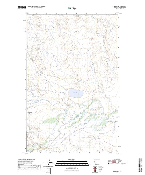
2024 Map of Sharp Lake
USGS Topo · Published 2024About this map
Sharp Lake sits at the center of this high-plains landscape in Glacier County, where the terrain is defined by a network of drainage coulees and ephemeral creeks. The map documents a sparsely populated ranching and tribal land context, characterized by long-established routes like 3 C Bar Rd and Finley Ranch Rd. The presence of the Nightshoot Cem and roads such as Boarding School Rd and Yellow Wolf Rd reflect the cultural footprint of the Blackfeet Indian Reservation.
Find a feature on this map
22 named features on this map. Tap any name to fly to it.
Don’t see what you’re looking for? This feature index may not catch every label — zoom into the map to look around manually.
Map Details
Editions of this 2024 Sharp Lake Map
This is the sole edition of this map. No revisions or reprints were ever made.
Other maps of this area

1901 · Browning
USGS Topo · 1:125,000

1903 · Browning
USGS Topo · 1:125,000

1911 · Blackfoot
USGS Topo · 1:125,000

1960 · Cut Bank
USGS Topo · 1:250,000

1963 · Cut Bank
USGS Topo · 1:250,000

1964 · Cut Bank
USGS Topo · 1:250,000

1968 · Rimrock Butte
USGS Topo · 1:24,000

1968 · Hoodoo Hill
USGS Topo · 1:24,000

1968 · Browning NE
USGS Topo · 1:24,000
1968 · Browning
USGS Topo · 1:24,000