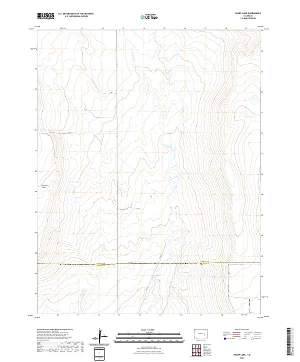
2022 Map of Sharp Lake
USGS Topo · Published 2022About this map
Horse Cr and Little Horse Cr define the hydrological character of this high plains landscape on the border of Lincoln and Crowley counties. The map captures a largely open, rural expanse where drainage patterns like Steels Fork and Pond Cr dictate the layout of the sparse road network, including Co Rd A and Field Rd. A significant terrain feature, Ninemile Flats, occupies the western portion of the sheet, illustrating the level topography characteristic of this part of eastern Colorado. Near the northeastern corner, Sharp Lake provides a rare perennial water feature in an otherwise arid environment. The surveyed township and range lines, such as t17s r56w, overlay a traditional grid of section roads like Co Rd E and Rd F, which remain the primary infrastructure for the cattle ranching or dryland farming operations common to this region.
Find a feature on this map
19 named features on this map. Tap any name to fly to it.
Don’t see what you’re looking for? This feature index may not catch every label — zoom into the map to look around manually.
Map Details
Editions of this 2022 Sharp Lake Map
This is the sole edition of this map. No revisions or reprints were ever made.
Other maps of this area

1889 · Sanborn
USGS Topo · 1:125,000

1891 · Sanborn
USGS Topo · 1:125,000

1891 · Catlin
USGS Topo · 1:125,000

1893 · Sanborn
USGS Topo · 1:125,000

1893 · Catlin
USGS Topo · 1:125,000

1954 · Lamar
USGS Topo · 1:250,000

1958 · Lamar
USGS Topo · 1:250,000

1977 · Walker Point
USGS Topo · 1:24,000
1977 · The Pinnacles
USGS Topo · 1:24,000
1977 · Box Springs
USGS Topo · 1:24,000