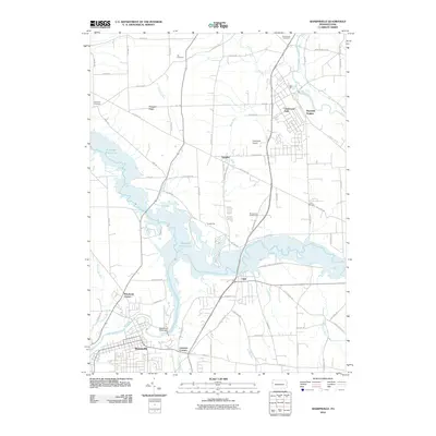
2010 Map of Sharpsville
USGS Topo · Published 2010About this map
Sharpsville and the winding course of the Shenango River anchor this 2010 topographic record of Mercer County. The landscape is defined by the massive footprint of the Shenango River Lake, which stretches from the Shenango River Dam northward, flooding the valley and altering the historic path of numerous tributaries like Chestnut Run and McCullough Run. This modern survey illustrates the proximity of residential developments like Reynolds Heights and Greencrest Park to the managed water system, while preserving the locations of older landmarks such as Fell Cemetery and Zion Cemetery. The transition from the established street grid of the borough to the outlying agricultural areas like Pymatuning and Transfer shows the persistent rural-suburban character of the region. Local transportation and recreation are represented by the presence of Napodano Airport and the Birchwood Golf Course, situated along the eastern ridges overlooking the reservoir.
Find a feature on this map
78 named features on this map. Tap any name to fly to it.
Don’t see what you’re looking for? This feature index may not catch every label — zoom into the map to look around manually.
Map Details
Editions of this 2010 Sharpsville Map
This is the sole edition of this map. No revisions or reprints were ever made.
Other maps of this area

1905 · Neshannock
USGS Topo · 1:62,500

1906 · Youngstown
USGS Topo · 1:62,500

1907 · Neshannock
USGS Topo · 1:62,500

1907 · Kinsman
USGS Topo · 1:62,500

1908 · Shenango
USGS Topo · 1:62,500

1908 · Youngstown
USGS Topo · 1:62,500

1950 · Cleveland
USGS Topo · 1:250,000

1954 · Sharon West
USGS Topo · 1:24,000

1956 · Cleveland
USGS Topo · 1:250,000

1958 · Sharpsville
USGS Topo · 1:24,000