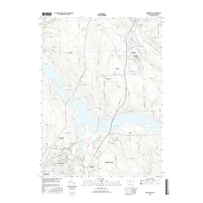
2016 Map of Sharpsville
USGS Topo · Published 2016About this map
The Shenango River Lake dominates the central landscape of this Mercer County survey, a sprawling reservoir that reshaped the local geography north of Sharon. Along its southern reaches, the borough of Sharpsville and the community of Clark stand as primary population centers, while the upland areas of Hermitage show a pattern of modern residential expansion. To the north, the industrial and residential clusters of Reynolds Heights and Greencrest Park sit near the Napodano Airport, indicating the area's mid-to-late 20th-century development. Evidence of the region's earlier rural heritage is preserved in the numerous family and community burial grounds scattered across the terrain, including Fell Cem, Good Hope Cem, and Zion Cem. Notable geographic markers such as Prospect Ridge and the winding course of the Shenango River below the dam provide a clear picture of the land's natural contours before the reservoir's creation.
Find a feature on this map
151 named features on this map. Tap any name to fly to it.
Don’t see what you’re looking for? This feature index may not catch every label — zoom into the map to look around manually.
Map Details
Editions of this 2016 Sharpsville Map
This is the sole edition of this map. No revisions or reprints were ever made.
Other maps of this area

1905 · Neshannock
USGS Topo · 1:62,500

1906 · Youngstown
USGS Topo · 1:62,500

1907 · Neshannock
USGS Topo · 1:62,500

1907 · Kinsman
USGS Topo · 1:62,500

1908 · Shenango
USGS Topo · 1:62,500

1908 · Youngstown
USGS Topo · 1:62,500

1950 · Cleveland
USGS Topo · 1:250,000

1954 · Sharon West
USGS Topo · 1:24,000

1956 · Cleveland
USGS Topo · 1:250,000

1958 · Sharpsville
USGS Topo · 1:24,000