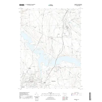
2019 Map of Sharpsville
USGS Topo · Published 2019About this map
Sharon and Hermitage dominate the southern portion of this region, where the Shenango River flows through the industrial and residential heart of Mercer County. This 2019 survey captures the modern landscape of the Shenango Valley, defined by the large expanse of Shenango River Lake and its surrounding recreational and residential areas. To the north, the terrain transitions into a more rural pattern of crossroads and small settlements like Transfer and Pritchards Corner. Notable for genealogists, the map identifies numerous burial grounds including Riverside Cem near the riverbanks and the more isolated Fell Cem and Reichard Cem. The infrastructure of the era is evident in the residential clusters of Reynolds Heights and Greencrest Park, as well as the active operations at Napodano Airport.
Find a feature on this map
166 named features on this map. Tap any name to fly to it.
Don’t see what you’re looking for? This feature index may not catch every label — zoom into the map to look around manually.
Map Details
Editions of this 2019 Sharpsville Map
This is the sole edition of this map. No revisions or reprints were ever made.
Other maps of this area

1905 · Neshannock
USGS Topo · 1:62,500

1906 · Youngstown
USGS Topo · 1:62,500

1907 · Neshannock
USGS Topo · 1:62,500

1907 · Kinsman
USGS Topo · 1:62,500

1908 · Shenango
USGS Topo · 1:62,500

1908 · Youngstown
USGS Topo · 1:62,500

1950 · Cleveland
USGS Topo · 1:250,000

1954 · Sharon West
USGS Topo · 1:24,000

1956 · Cleveland
USGS Topo · 1:250,000

1958 · Sharpsville
USGS Topo · 1:24,000