
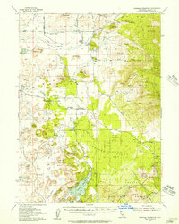
1922 Map of Shasta Valley Sheet No 10 E
USGS Topo · Published 1922About this map
C. A. Stonesifer surveyed this pocket of the Klamath-Shasta Valley in 1922, capturing the distinct volcanic topography of Siskiyou County. The landscape is dominated by the prominent profile of Yellow Butte, which stands out against the intricate contour lines of the surrounding terrain. A particularly unique element of this survey is the detailed recording of subterranean features known simply as The Caves. The map includes a specific cartographic note indicating that dots at this location represent the actual direction of the cave passages, providing rare documentation of the local underworld geography during this era of irrigation expansion and land reclamation by the State of California.
Find a feature on this map
5 named features on this map. Tap any name to fly to it.
Don’t see what you’re looking for? This feature index may not catch every label — zoom into the map to look around manually.
Map Details
Editions of this 1922 Shasta Valley Sheet No 10 E Map
This is the sole edition of this map. No revisions or reprints were ever made.
Other maps of this area

1886 · Shasta
USGS Topo · 1:250,000

1894 · Shasta
USGS Topo · 1:250,000

1921 · Shasta Valley Sheet No 11
USGS Topo · 1:24,000

1922 · Shasta Valley Sheet No 10
USGS Topo · 1:24,000

1934 · Macdoel
USGS Topo · 1:96,000

1941 · Macdoel
USGS Topo · 1:125,000

1948 · Weed
USGS Topo · 1:250,000

1950 · Weed
USGS Topo · 1:250,000

1954 · The Whaleback
USGS Topo · 1:62,500
1954 · Dwinnell Reservoir
USGS Topo · 1:62,500