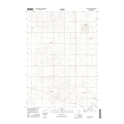
2017 Map of Shattuck Butte
USGS Topo · Published 2017About this map
Oakland Valley sits at the base of the intricate agricultural and water management network defining this portion of Bonneville County. The landscape is structured by a rigid section-line road grid, including N 105 W and W 129 N, which facilitates the movement of resources through the high desert terrain. Water control is paramount to the local economy, evidenced by the presence of the Oakland Canal, Martin Canal, and the Beckman Ditch, which redirect flow across the plains to support the region's farms. Rising above the relatively level agricultural tracts is Shattuck Butte, the area's most prominent natural landmark, providing a stark topographical contrast to the surrounding fields. The inclusion of the Q B One Airport reflects the continued integration of modern aviation within this rural environment, while the underlying Public Land Survey System grids, such as t3n r36e, highlight the historical persistence of early Idaho land divisions.
Find a feature on this map
22 named features on this map. Tap any name to fly to it.
Don’t see what you’re looking for? This feature index may not catch every label — zoom into the map to look around manually.
Map Details
Editions of this 2017 Shattuck Butte Map
This is the sole edition of this map. No revisions or reprints were ever made.
Other maps of this area

1948 · Woodville
USGS Topo · 1:24,000

1948 · Lewisville
USGS Topo · 1:24,000

1948 · Idaho Falls North
USGS Topo · 1:24,000

1948 · Idaho Falls South
USGS Topo · 1:24,000

1949 · Idaho Falls North
USGS Topo · 1:24,000

1949 · Lewisville
USGS Topo · 1:24,000

1949 · Roberts
USGS Topo · 1:62,500

1949 · Roberts
USGS Topo · 1:24,000

1949 · Shattuck Butte
USGS Topo · 1:24,000

1950 · Shattuck Butte
USGS Topo · 1:24,000