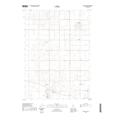
2020 Map of Shattuck Butte
USGS Topo · Published 2020About this map
Shattuck Butte stands as the primary topographical landmark in this high-desert portion of Bonneville County, overlooking a landscape defined by industrial-scale agriculture and recreational corridors. The southern portion of the quadrangle highlights the complex water management systems essential to the region, featuring the Oakland Canal, Martin Canal, and Beckman Ditch. These waterways support the rural community of Oakland Valley, where the road network transitions from standard thoroughfares like Airway Rd to specialized paths. Evidence of local land use is further seen in the Noise Park Twister Atv trails and the Boundary Trail, suggesting a modern interplay between agricultural production and backcountry recreation near the intersection of the T3N and T2N township lines.
Find a feature on this map
18 named features on this map. Tap any name to fly to it.
Don’t see what you’re looking for? This feature index may not catch every label — zoom into the map to look around manually.
Map Details
Editions of this 2020 Shattuck Butte Map
This is the sole edition of this map. No revisions or reprints were ever made.
Other maps of this area

1948 · Woodville
USGS Topo · 1:24,000

1948 · Lewisville
USGS Topo · 1:24,000

1948 · Idaho Falls North
USGS Topo · 1:24,000

1948 · Idaho Falls South
USGS Topo · 1:24,000

1949 · Idaho Falls North
USGS Topo · 1:24,000

1949 · Lewisville
USGS Topo · 1:24,000

1949 · Roberts
USGS Topo · 1:62,500

1949 · Roberts
USGS Topo · 1:24,000

1949 · Shattuck Butte
USGS Topo · 1:24,000

1950 · Shattuck Butte
USGS Topo · 1:24,000