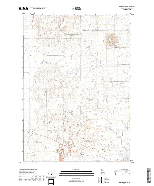
2023 Map of Shattuck Butte
USGS Topo · Published 2023About this map
Shattuck Butte rises as the dominant landform in this Bonneville County landscape, providing a high-point perspective over the surrounding agricultural plains. The southeastern portion of the map is defined by the Oakland Valley, a region where water management is critical to the local economy. A complex network of irrigation infrastructure, including the Oakland Canal, the Martin Canal, and the Oakland Waste, demonstrates the engineered nature of the valley's water distribution. These waterways, alongside the Beckman Ditch, trace the essential movement of water through this high-desert environment. The section-line road grid, featuring routes like Airway Rd and W 129 N, anchors the area's rural development pattern, reflecting a landscape shaped by precise surveying and systematic irrigation.
Find a feature on this map
17 named features on this map. Tap any name to fly to it.
Don’t see what you’re looking for? This feature index may not catch every label — zoom into the map to look around manually.
Map Details
Editions of this 2023 Shattuck Butte Map
This is the sole edition of this map. No revisions or reprints were ever made.
Other maps of this area

1948 · Woodville
USGS Topo · 1:24,000

1948 · Lewisville
USGS Topo · 1:24,000

1948 · Idaho Falls North
USGS Topo · 1:24,000

1948 · Idaho Falls South
USGS Topo · 1:24,000

1949 · Idaho Falls North
USGS Topo · 1:24,000

1949 · Lewisville
USGS Topo · 1:24,000

1949 · Roberts
USGS Topo · 1:62,500

1949 · Roberts
USGS Topo · 1:24,000

1949 · Shattuck Butte
USGS Topo · 1:24,000

1950 · Shattuck Butte
USGS Topo · 1:24,000