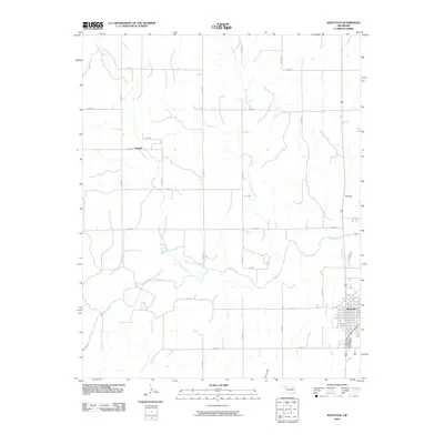
2010 Map of Shattuck
USGS Topo · Published 2010About this map
Shattuck stands as the primary hub in this corner of the Oklahoma Panhandle region, showing its organized street grid along the eastern edge of the survey. The landscape is defined by the drainage basins of several prominent waterways, including Wolf Creek, which meanders across the center of the sheet, and its tributaries like Rock Creek and Ivanhoe Creek. The terrain features the distinct landmark of Flat Top to the north of the main settlement. Further west, the small locale of Touzalin is situated among a network of county roads. The map reveals a rural economy built on a geometric section-line road system, with routes such as n1720 RD and e0490 RD connecting isolated farmsteads across the prairie. This 2010 edition by the U.S. Geological Survey captures the modern infrastructure of Ellis County while preserving the names of the original creek networks like Six Pony Creek and Long Creek.
Find a feature on this map
24 named features on this map. Tap any name to fly to it.
Don’t see what you’re looking for? This feature index may not catch every label — zoom into the map to look around manually.
Map Details
Editions of this 2010 Shattuck Map
This is the sole edition of this map. No revisions or reprints were ever made.
Other maps of this area

1954 · Perryton
USGS Topo · 1:250,000

1955 · Woodward
USGS Topo · 1:250,000

1958 · Perryton
USGS Topo · 1:250,000

1958 · Woodward
USGS Topo · 1:250,000

1969 · Shattuck
USGS Topo · 1:24,000

1969 · Shattuck NW
USGS Topo · 1:24,000

1969 · Gage
USGS Topo · 1:24,000

1969 · Shattuck NE
USGS Topo · 1:24,000

1970 · Arnett
USGS Topo · 1:24,000

1970 · Goodwin
USGS Topo · 1:24,000