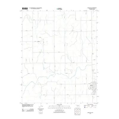
2012 Map of Shattuck
USGS Topo · Published 2012About this map
Shattuck stands as the primary hub in this corner of Ellis County, Oklahoma, where the local street grid centers on Oklahoma Ave and Elm St. The surrounding high plains landscape is defined by the drainage patterns of Wolf Cr and its various tributaries, including Ivanhoe Cr and Mammoth Cr. A network of numbered section-line roads, such as N1700 Rd and E0480 Rd, organizes the ranching and agricultural land between the small settlement of Touzalin and the prominent rise of Flat Top to the east.
Find a feature on this map
37 named features on this map. Tap any name to fly to it.
Don’t see what you’re looking for? This feature index may not catch every label — zoom into the map to look around manually.
Map Details
Editions of this 2012 Shattuck Map
This is the sole edition of this map. No revisions or reprints were ever made.
Other maps of this area

1954 · Perryton
USGS Topo · 1:250,000

1955 · Woodward
USGS Topo · 1:250,000

1958 · Perryton
USGS Topo · 1:250,000

1958 · Woodward
USGS Topo · 1:250,000

1969 · Shattuck
USGS Topo · 1:24,000

1969 · Shattuck NW
USGS Topo · 1:24,000

1969 · Gage
USGS Topo · 1:24,000

1969 · Shattuck NE
USGS Topo · 1:24,000

1970 · Arnett
USGS Topo · 1:24,000

1970 · Goodwin
USGS Topo · 1:24,000