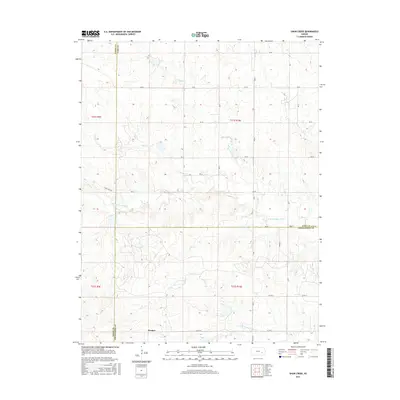
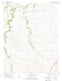
2015 Map of Shaw Creek
USGS Topo · Published 2015About this map
Kenbro sits in the southern portion of this landscape, a quiet settlement located near the tri-county junction of Lyon, Chase, and Greenwood counties. The terrain is defined by the headwaters and drainages of the Verdigris River system, including the N Br Verdigris River and S Br Verdigris River. This area represents a classic Kansas rural agricultural grid, where a network of section-line roads like RD 50 and RD 30 intersect the meandering paths of Shaw Cr and Rock Cr. The topography reveals the subtle elevation changes of the Flint Hills region, with drainage patterns that have historically dictated the placement of homesteads and the layout of local corridors such as Camp Creek Rd.
Find a feature on this map
27 named features on this map. Tap any name to fly to it.
Don’t see what you’re looking for? This feature index may not catch every label — zoom into the map to look around manually.
Map Details
Editions of this 2015 Shaw Creek Map
This is the sole edition of this map. No revisions or reprints were ever made.
Other maps of this area

1888 · Emporia
USGS Topo · 1:125,000

1894 · Emporia
USGS Topo · 1:125,000

1955 · Hutchinson
USGS Topo · 1:250,000

1959 · Hutchinson
USGS Topo · 1:250,000

1967 · Madison SW
USGS Topo · 1:24,000
1967 · Thrall
USGS Topo · 1:24,000
1967 · Teterville
USGS Topo · 1:24,000
1973 · Olpe
USGS Topo · 1:24,000

1973 · Shaw Creek
USGS Topo · 1:24,000
1973 · Gladstone
USGS Topo · 1:24,000