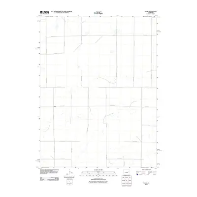
2010 Map of Shaw
USGS Topo · Published 2010About this map
Shaw sits as the central point of interest in this eastern Colorado landscape, where a rigid grid of rural roads meets the winding path of the North Fork Arikaree River. This 2010 survey by the U.S. Geological Survey illustrates a sparsely populated section of Lincoln County, defined by its agricultural layout and intermittent watercourses. The drainage of Gordon Creek cuts through the northern portion of the quadrangle, while the southern reaches are marked by the rhythmic intersection of routes like County Rd-4c and County Road U. The map provides a clear look at the region's land management, showing how the natural topography of the river valley contrasts with the engineered precision of the county road system, including County Hwy-0. It is an essential document for understanding the modern rural infrastructure and water rights of the high plains.
Find a feature on this map
23 named features on this map. Tap any name to fly to it.
Don’t see what you’re looking for? This feature index may not catch every label — zoom into the map to look around manually.
Map Details
Editions of this 2010 Shaw Map
This is the sole edition of this map. No revisions or reprints were ever made.
Other maps of this area

1954 · Limon
USGS Topo · 1:250,000

1957 · Limon
USGS Topo · 1:250,000

1958 · Limon
USGS Topo · 1:250,000

1973 · Lindon NE
USGS Topo · 1:24,000

1973 · Lindon SW
USGS Topo · 1:24,000

1973 · Lindon
USGS Topo · 1:24,000

1973 · Shaw
USGS Topo · 1:24,000

1977 · Thurman
USGS Topo · 1:24,000
1978 · Anton
USGS Topo · 1:24,000

1979 · Arriba NW
USGS Topo · 1:24,000