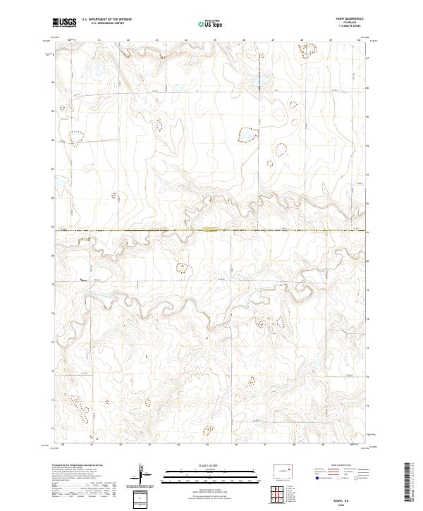
2022 Map of Shaw
USGS Topo · Published 2022About this map
The settlement of Shaw sits at the intersection of a vast agricultural and prairie landscape where the Washington Co and Lincoln Co lines meet. The terrain is defined by the winding course of the North Fork Arikaree River, which carves a complex series of bluffs and drainage patterns through the center of the region. This river system, along with its tributary Gordon Creek in the north, dictates the orientation of the local road network, which primarily follows the rectilinear Public Land Survey System grid except where diverted by the river's topography.
Find a feature on this map
28 named features on this map. Tap any name to fly to it.
Don’t see what you’re looking for? This feature index may not catch every label — zoom into the map to look around manually.
Map Details
Editions of this 2022 Shaw Map
This is the sole edition of this map. No revisions or reprints were ever made.
Other maps of this area

1954 · Limon
USGS Topo · 1:250,000

1957 · Limon
USGS Topo · 1:250,000

1958 · Limon
USGS Topo · 1:250,000

1973 · Lindon NE
USGS Topo · 1:24,000

1973 · Lindon SW
USGS Topo · 1:24,000

1973 · Lindon
USGS Topo · 1:24,000

1973 · Shaw
USGS Topo · 1:24,000

1977 · Thurman
USGS Topo · 1:24,000
1978 · Anton
USGS Topo · 1:24,000

1979 · Arriba NW
USGS Topo · 1:24,000