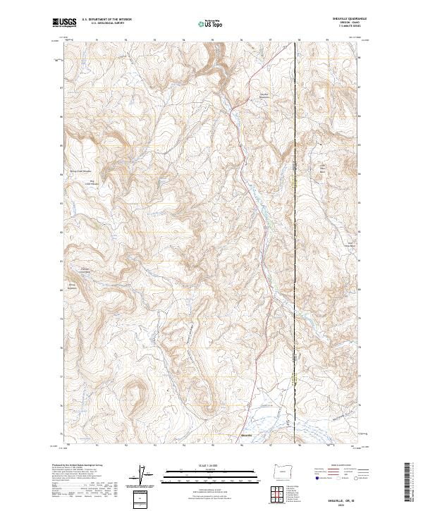
2023 Map of Sheaville
USGS Topo · Published 2023About this map
Sheaville sits at the southern edge of this modern survey, where the high desert of the Owyhee Mountains straddles the border between Oregon and Idaho. The landscape is defined by its water sources and livestock history, marked by numerous named springs such as Sticky Joe Spring, Baltzar Spring, and Badger Spring. These water points support the expansive grazing lands of Spring Creek Meadow and Dog Creek Meadow.
Find a feature on this map
46 named features on this map. Tap any name to fly to it.
Don’t see what you’re looking for? This feature index may not catch every label — zoom into the map to look around manually.
Map Details
Editions of this 2023 Sheaville Map
This is the sole edition of this map. No revisions or reprints were ever made.
Other maps of this area

1892 · Silver City
USGS Topo · 1:125,000

1894 · Silver City
USGS Topo · 1:125,000

1898 · Silver City
USGS Topo · 1:125,000

1955 · Boise
USGS Topo · 1:250,000

1957 · Sands Basin
USGS Topo · 1:62,500

1958 · Boise
USGS Topo · 1:250,000

1962 · Boise
USGS Topo · 1:250,000

1965 · Rooster Comb Peak
USGS Topo · 1:62,500

1967 · Rockville
USGS Topo · 1:24,000
1967 · Bannock Ridge
USGS Topo · 1:24,000