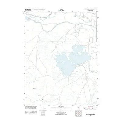
2011 Map of Sheckler Reservoir
USGS Topo · Published 2011About this map
The Sheckler Reservoir dominates the center of this landscape in the Lahontan Valley, serving as a critical water management feature within the high desert of Nevada. This terrain is characterized by the complex irrigation network of the V Line Canal and the meandering path of the Carson River as it flows toward the basin. The map preserves the historic alignment of the California Emigrant Trl, a route that once carried thousands of overland travelers across these flats. South of the agricultural activity near Frey Ranch, the topography rises sharply into the Dead Camel Mountains. Distinctive peaks such as Red Mountain and the uniquely named The Nipple overlook the valley, while smaller hydrographic features like Twenty Six Foot Drop indicate the engineered nature of the regional water system in the early 21st century.
Find a feature on this map
21 named features on this map. Tap any name to fly to it.
Don’t see what you’re looking for? This feature index may not catch every label — zoom into the map to look around manually.
Map Details
Editions of this 2011 Sheckler Reservoir Map
This is the sole edition of this map. No revisions or reprints were ever made.
Other maps of this area

1890 · Wadsworth
USGS Topo · 1:125,000

1891 · Wabuska
USGS Topo · 1:125,000

1892 · Wadsworth
USGS Topo · 1:125,000

1894 · Wadsworth
USGS Topo · 1:125,000

1894 · Wabuska
USGS Topo · 1:125,000

1908 · Carson Sink
USGS Topo · 1:250,000

1910 · Carson Sink
USGS Topo · 1:250,000

1951 · Soda Lake
USGS Topo · 1:62,500

1951 · Fallon
USGS Topo · 1:62,500

1957 · Two Tips
USGS Topo · 1:62,500